


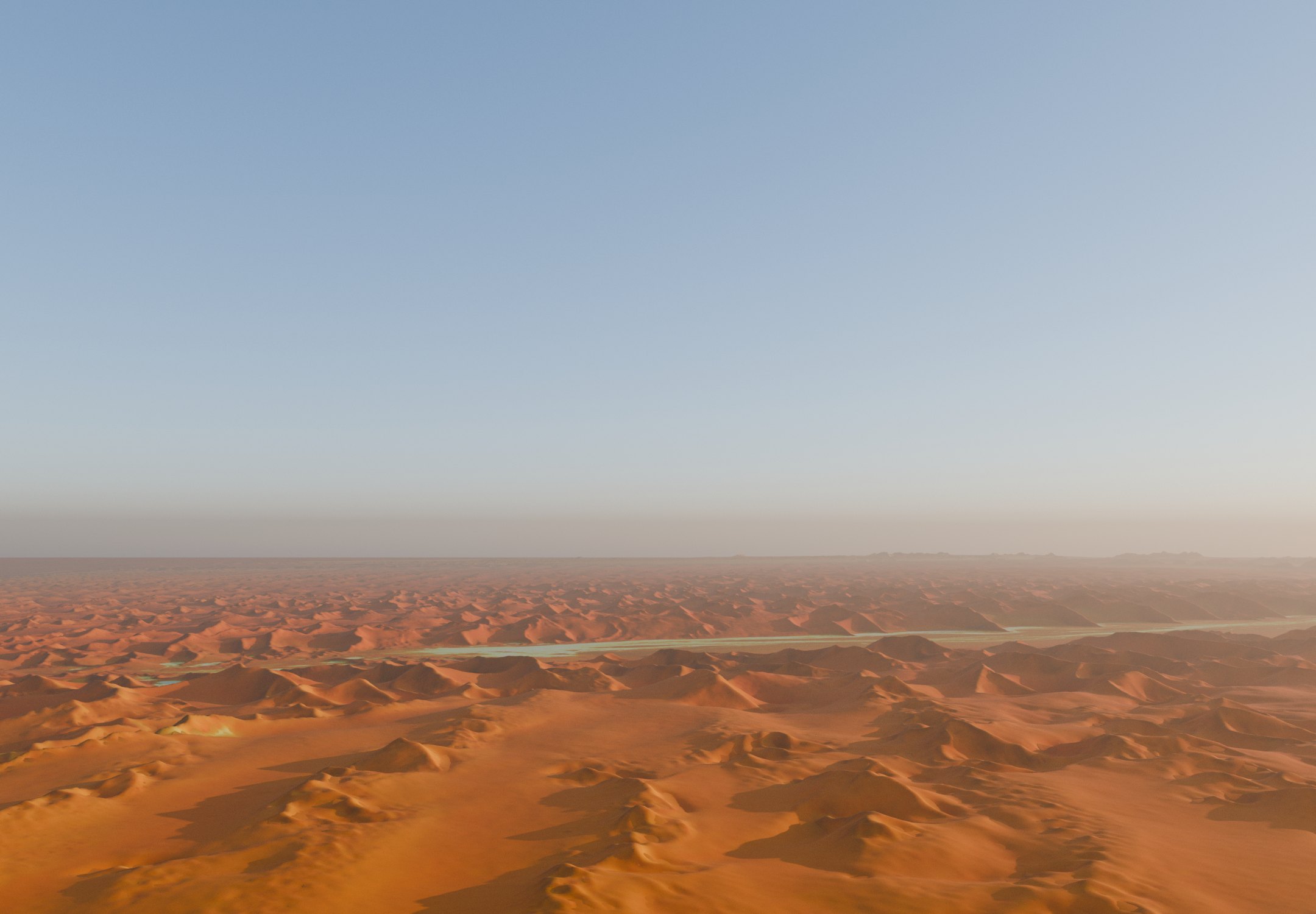
Interactive globe
Drag a desert across the globe
Pick a desert and drag it anywhere: it keeps its true size and shape on the sphere. Drag the globe itself to turn it.
Interactive map
Where the deserts are
Every desert outline in Natural Earth on an equal-area map, coloured by climate type. Tap a desert for its area or switch types on and off.
Swipe sideways to see the whole map.
Real relief
Twenty deserts, cut from the Earth
Each model is cut along the desert’s outline from satellite elevation and imagery, and carries its own scale bar. Tap one to find it on the globe and the map.
Relief: NOAA ETOPO 2022 (15 arc-seconds, thinned to about 720 points across each model), heights exaggerated as marked. Colour: Sentinel-2 cloudless 2016; Antarctica, which that mosaic does not cover, is shaded as snow and ice, with bare rock where ETOPO shows no ice. Outlines: Natural Earth; the sea inside them is drawn flat. The Arabian, Patagonian, Great Basin and Ogaden models use wider regions, the Australian model shows the six of its ten deserts that are mapped, and the Arctic Desert, which has no mapped boundary, is shown as everything north of the Arctic Circle. * Likely includes sea ice.
The top 20 at true scale
Squares of true area
Each block’s area matches the desert’s listed area. Switch the polar deserts off and the Sahara becomes the giant.
Same scale, same shape
The Sahara vs the United States and China
The Sahara’s outline, moved without distortion and drawn on an equal-area map at the same scale as each country.
Rain gauges
Under 250 mm a year
Each gauge is filled to the desert’s yearly rain and snow. The dashed line is the 250 mm desert threshold.
Records
Heat, cold and sand
The hottest, coldest and tallest records come from deserts.
Temperature records
The tallest dunes
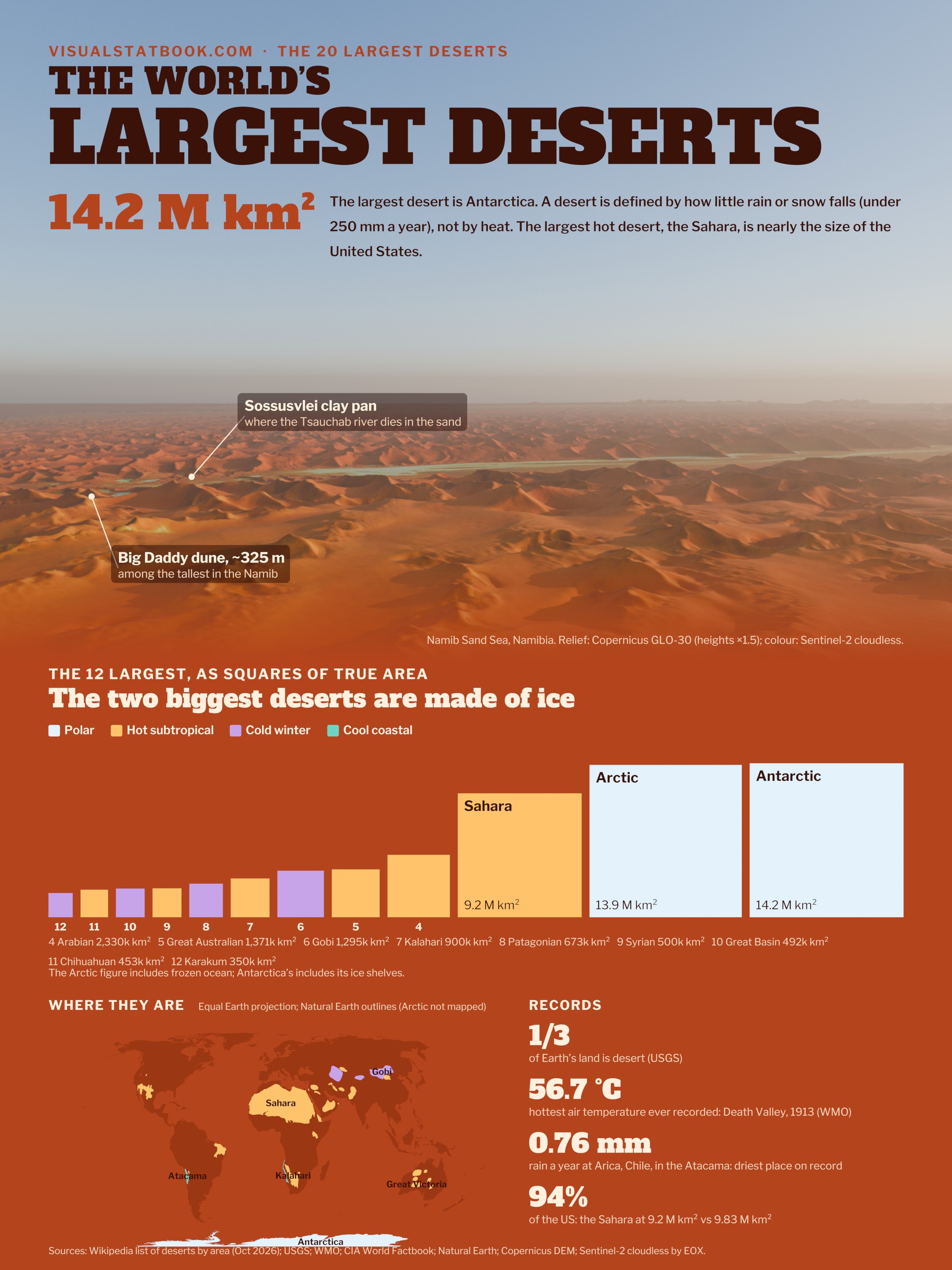
The poster
Ice, sand and stone on one page
The Namib dunes, the 12 largest deserts at true scale, the desert map and four records, on a 2160 × 2880 poster.
Open the full-size posterShow the full data table
| # | Non-polar | Desert | Type | Area (km²) | Countries | Precipitation (mm/yr) |
|---|---|---|---|---|---|---|
| 1 | – | Antarctic Desert | Polar | 14,200,000 | None (Antarctic Treaty) | ~150 (interior under 50) |
| 2 | – | Arctic Desert | Polar | 13,900,000* | Canada, Finland, Greenland (Denmark), Iceland, Norway, Russia, Sweden, United States | under 250 (polar desert) |
| 3 | 1 | Sahara | Hot subtropical | 9,200,000 | Algeria, Chad, Egypt, Eritrea, Libya, Mali, Mauritania, Morocco, Niger, Sudan, Tunisia, Western Sahara | under 1 in the core to ~150 at the edges |
| 4 | 2 | Arabian Desert | Hot subtropical | 2,330,000 | Egypt (Sinai), Iraq, Israel, Jordan, Kuwait, Oman, Palestine, Qatar, Saudi Arabia, United Arab Emirates, Yemen | ~100 |
| 5 | 3 | Great Australian Desert | Hot subtropical | 1,371,000 | Australia | ~250 |
| 6 | 4 | Gobi Desert | Cold winter, rain shadow | 1,295,000 | China, Mongolia | ~194 |
| 7 | 5 | Kalahari Desert | Hot subtropical | 900,000 | Botswana, Namibia, South Africa | 110–200 in the driest parts |
| 8 | 6 | Patagonian Desert | Cold winter, rain shadow | 673,000 | Argentina, Chile | under 200 |
| 9 | 7 | Syrian Desert | Hot subtropical | 500,000 | Iraq, Jordan, Saudi Arabia, Syria | under ~125 |
| 10 | 8 | Great Basin Desert | Cold winter, rain shadow | 492,000 | United States | ~230–300 |
| 11 | 9 | Chihuahuan Desert | Hot subtropical | 453,248 | Mexico, United States | 235 (range ~150–400) |
| 12 | 10 | Karakum Desert | Cold winter | 350,000 | Turkmenistan | 70–150 |
| 13 | 11 | Taklamakan Desert | Cold winter, rain shadow | 337,000 | China | ~26 at Tazhong |
| 14 | 12 | Colorado Plateau | Cold winter | 336,698 | United States | 150–400 |
| 15 | 13 | Sonoran Desert | Hot subtropical | 310,799 | Mexico, United States | under 90 to 300 |
| 16 | 14 | Kyzylkum Desert | Cold winter | 297,849 | Kazakhstan, Turkmenistan, Uzbekistan | 100–200 |
| 17 | 15 | Thar Desert | Hot subtropical | 264,091 | India, Pakistan | 100–300 (monsoon) |
| 18 | 16 | Ogaden Desert | Hot subtropical | 200,000 | Ethiopia, Somalia, Somaliland | 350 or less (semi-arid) |
| 19 | 17 | Ustyurt Plateau | Cold winter | 200,000 | Kazakhstan, Turkmenistan, Uzbekistan | – |
| 20 | 18 | Margo Desert (Dasht-e Margo) | Hot subtropical | 150,000 | Afghanistan | – |
* Likely includes sea ice. Areas from the Wikipedia list of deserts by area (mostly CIA World Factbook); other sources draw different boundaries, e.g. 9 to 11 M km² for the Sahara.
Questions
Desert FAQ
What is the largest desert in the world?
The Antarctic Desert, at about 14.2 million km². A desert is defined by low precipitation (generally under 250 mm a year), not by heat, so the icy polar regions count. The Arctic Desert is second at about 13.9 million km², although that figure likely includes sea ice.
What is the largest hot desert?
The Sahara, at about 9.2 million km² (CIA World Factbook), covering about 31% of Africa across 12 countries and territories. Estimates range from about 9 million km² to 11 million km² depending on where the boundary is drawn.
Is Antarctica really a desert?
Yes. Antarctica receives only about 150 mm of precipitation a year on average (water equivalent), and under 50 mm in the interior. The USGS classes it as a polar desert: under 250 mm a year with a warmest-month average below 10 °C.
How much of Earth’s land is desert?
About one-third of Earth’s land surface is desert, according to the USGS.
Is the Sahara bigger than the United States?
Almost. At 9.2 million km² the Sahara is about 94% of the total area of the United States (9.83 million km²) and slightly larger than the US land area alone (9.15 million km²). It is about 96% of the size of China (9.60 million km²).
Which desert is the hottest and which is the driest?
The highest air temperature on record, 56.7 °C, was measured at Furnace Creek in Death Valley (Mojave Desert) in 1913. Satellites measured a ground-surface temperature of 70.7 °C in Iran’s Lut Desert in 2005. The driest place on record is Arica, Chile, in the Atacama Desert, with an average of 0.76 mm of rain a year (WMO).