


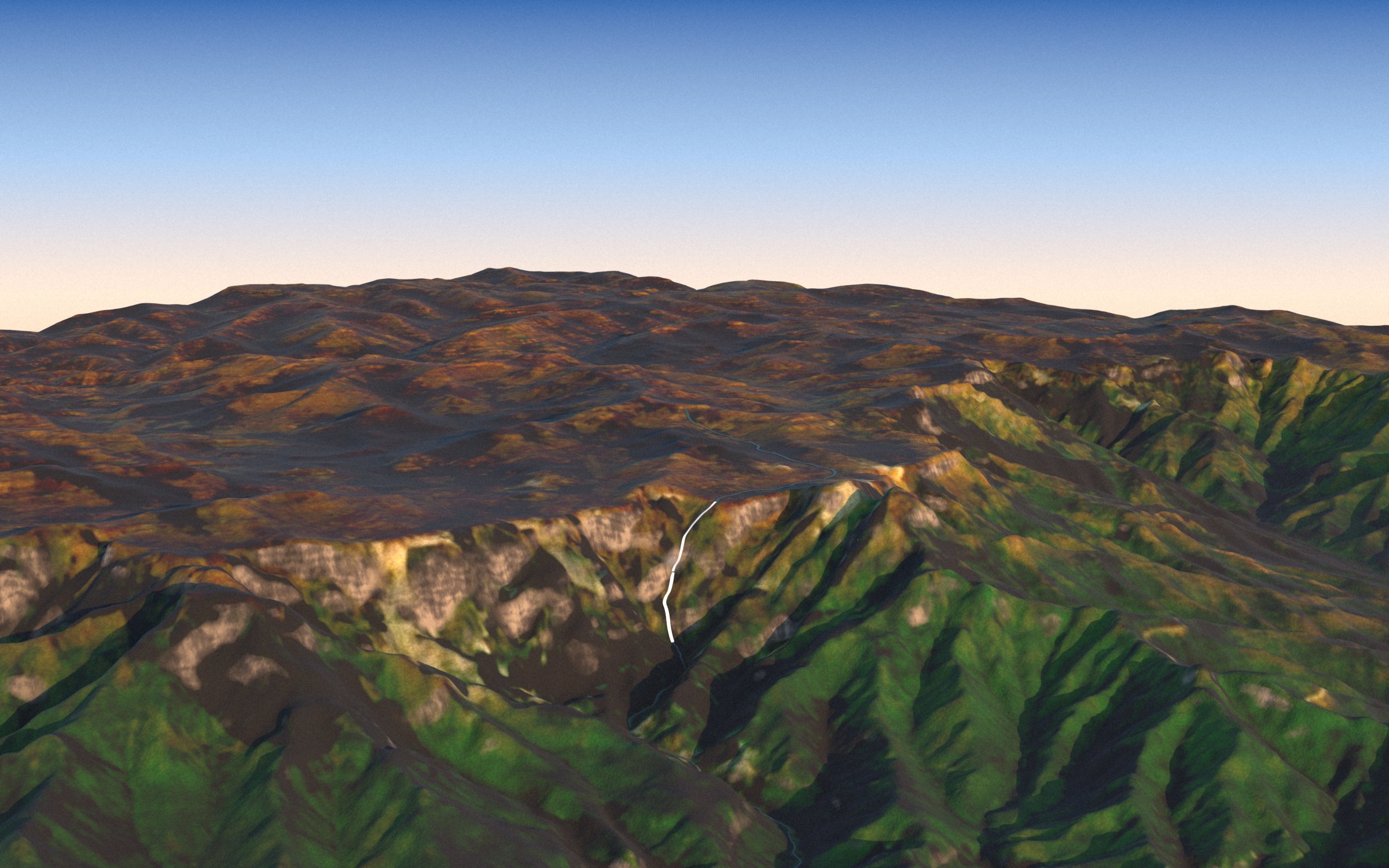
Scroll to fall
Drop 979 metres from the top of Angel Falls
Every one of the 20 highest falls stands here at one scale, with Burj Khalifa and the great river falls beside them. Scroll and the drop passes each top in turn.
Real profiles
Twenty cliffs, one scale
Each line is the ground along the stream, measured in the 30 m Copernicus terrain model, from 1.5 km above the lip to 2 km below the foot. Tap a line, or pick a region.
Where they fall
Fjords, sea cliffs and tepuis
The highest falls need a tall wall and a little water: glacier-cut fjords, Pacific sea cliffs and the table mountains of South America. Drag the globe or pick a fall.
3D terrain
All 20, modelled from the real ground
Each model is a 4 × 4 km block of real terrain at true height, coloured from satellite images, with the fall in white. Tap one to pick it everywhere on the page.
Every block is 4 × 4 km of Copernicus GLO-30 terrain (30 m cells) at true height, seen by the same camera at the same scale and turned to face the fall; the arrow points north. Colour is Sentinel-2 cloudless 2016; where that mosaic is cloudy (the Andes, Molokaʻi, Waihilau) the ground is shown in a plain average colour, and walls too steep for the satellite are shaded as bare rock. Water is drawn at least 40 m wide so it shows at this size. A 30 m model cannot hold a sheer wall: Angel’s 807 m plunge appears as a steep slope.
Which is the highest?
It depends on where you stop counting
Switch the rule and watch the top ten re-sort. Heights from distant surveys, lidar and rope descents do not always agree.
Angel Falls
979 m official total (1949 survey) · 807 m main plunge only (World Waterfall Database)
The 979 m figure matches the drop to the Churún river confluence, about 2 km from the cliff; the World Waterfall Database counts only the 807 m plunge.
Tugela Falls
983 m Czech survey, 2016 · 948 m five tiers (World Waterfall Database) · 411 m tallest single tier
The database notes the 2016 measurement was taken from more than 1 km from the base; with Angel at 807 m it ranks Tugela first.
Lists that aged
Often listed above 750 m, measured lower since:
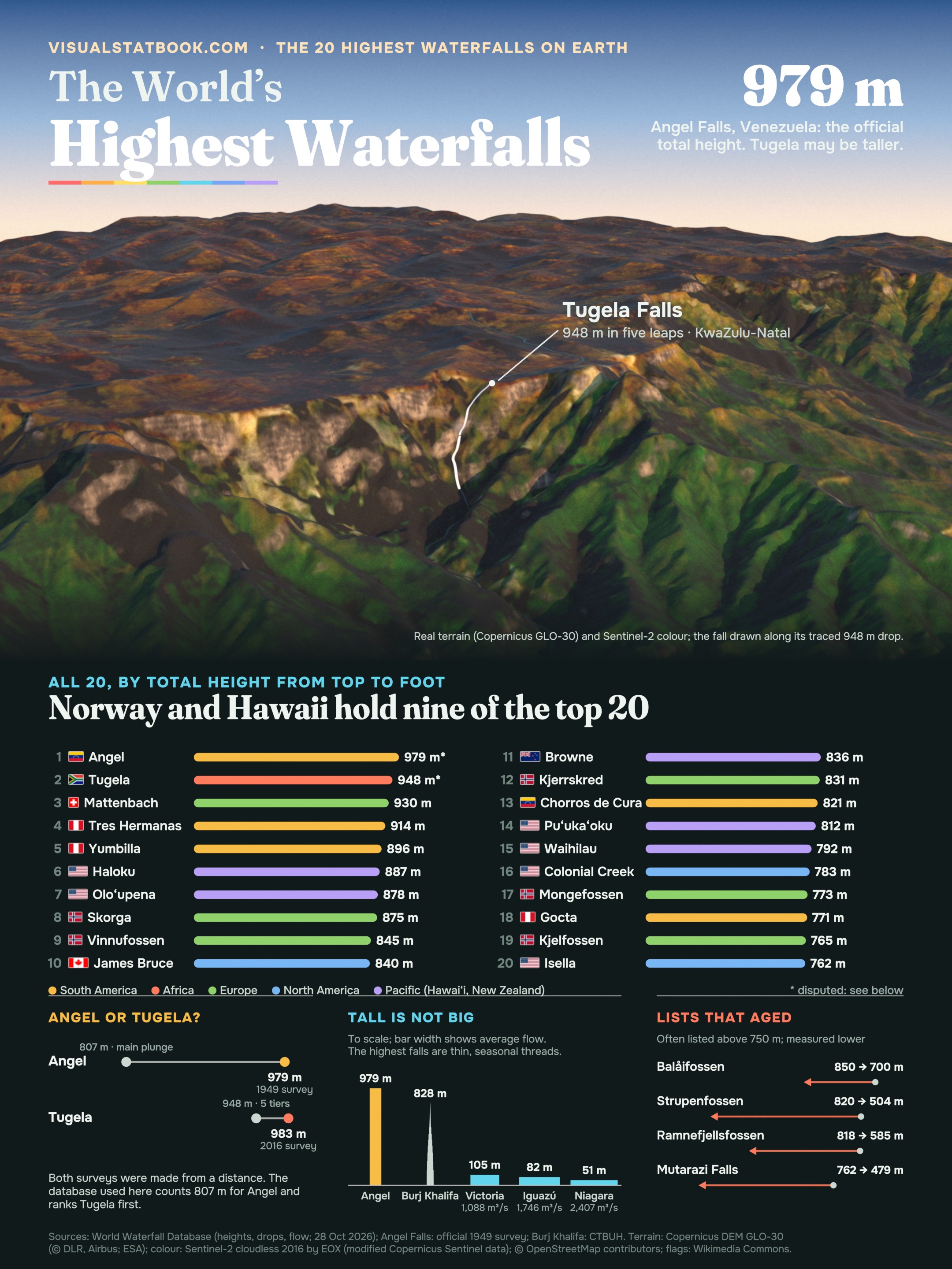
The poster
Twenty waterfalls on one page
The Drakensberg in golden light, the ranking with flags and the height debate on a 2160 × 2880 poster.
Open the full-size posterShow the full data table
| # | Waterfall | Where | Total m | Tallest drop m | Drops | Form | Flows | How measured |
|---|---|---|---|---|---|---|---|---|
| 1 | Angel Falls | Bolívar, Venezuela | 979 | 807 | 1 | Segmented Plunges | all year | 1949 survey by the Ruth Robertson expedition (official 979 m); the World Waterfall Database counts only the 807 m main plunge |
| 2 | Tugela Falls | KwaZulu-Natal, South Africa | 948 | 411 | 5 | Tiered Plunges | about 4 months (rainy season) | Long-quoted total of five tiers; a 2016 Czech survey gave 983 m, measured from over 1 km away |
| 3 | Mattenbachfälle | Bern, Switzerland | 930 | – | – | Tiered Horsetails | – | Measured on a rope descent by a canyoning team in 2020 (earlier estimate 840 m) |
| 4 | Tres Hermanas Falls | Junín, Peru | 914 | – | – | Tiered Horsetails | all year | Estimate supported by terrain profiles; not confirmed by survey |
| 5 | Yumbilla Falls | Amazonas, Peru | 896 | – | 4 | Tiered Horsetails | best in the rainy season | Laser survey by Peru's national geographic institute (IGN): 895.4 m |
| 6 | Haloku Falls | Hawaii (Molokaʻi), United States | 887 | 439 | 11 | Tiered Horsetails | – | Lidar elevation data, about eleven tiers |
| 7 | Oloʻupena Falls | Hawaii (Molokaʻi), United States | 878 | 241 | 17 | Tiered Horsetails | – | Lidar elevation data, about seventeen tiers |
| 8 | Skorga | Møre og Romsdal, Norway | 875 | – | – | Tiered Horsetails | about 9 months (april to july) | One-metre contour maps |
| 9 | Vinnufossen | Møre og Romsdal, Norway | 845 | 575 | 3 | Tiered Horsetails | about 9 months (may to september) | Surveyed on site by the World Waterfall Database |
| 10 | James Bruce Falls | British Columbia, Canada | 840 | – | – | Horsetail | – | Topographic estimate |
| 11 | Browne Falls | Southland (Fiordland), New Zealand | 836 | 244 | 6 | Steep Tiered Cascades | – | Topographic maps: drops from Lake Browne at 836 m to the sea |
| 12 | Kjerrskredfossen | Vestland, Norway | 831 | – | – | Tiered Plunges | about 7 months (march to june) | Surveyed on site by the World Waterfall Database in 2011 |
| 13 | Los Chorros de Cura | Aragua, Venezuela | 821 | 549 | 3 | Tiered Horsetails | – | Published tier heights; the database calls the figure unconfirmed |
| 14 | Puʻukaʻoku Falls | Hawaii (Molokaʻi), United States | 812 | 503 | 8 | Tiered Horsetails | – | Lidar elevation data, about eight tiers |
| 15 | Waihilau Falls | Hawaii (Big Island), United States | 792 | 792 | 1 | Segmented Horsetails | all year | Topographic estimate |
| 16 | Colonial Creek Falls | Washington, United States | 783 | – | 13 | Steep Tiered Cascades | all year | Triangulated on site in 2011 |
| 17 | Mongefossen | Møre og Romsdal, Norway | 773 | 773 | 1 | Veiling Horsetail | Snowmelt | Published height of the single drop |
| 18 | Gocta Falls | Amazonas, Peru | 771 | 540 | 2 | Tiered Plunges | all year | Two leaps; height published after Peruvian surveys in 2006 |
| 19 | Kjelfossen | Vestland, Norway | 765 | 198 | 8 | Tiered Plunges | about 10 months (march to july) | Surveyed on site by the World Waterfall Database (Vetle Kjelfossen, the tallest of three streams) |
| 20 | Isella Falls | Washington, United States | 762 | – | – | Segmented Steep Cascade | – | Estimated from topographic maps; the top is ill-defined below a glacier |
Total height runs from the top of the uppermost drop to the foot of the lowest, including the stream between tiers (World Waterfall Database definition). Heights, drops, form and flow are World Waterfall Database figures accessed on 28 October 2026; Angel Falls is listed at its official 979 m from the 1949 survey, while the database counts only its 807 m plunge.
Many falls on this list carry little water and run dry for part of the year; the database marks several heights as unconfirmed estimates.
Wikipedia’s list of waterfalls by height was used only as an index; several of its figures (for example 840 m for Mattenbachfälle, 900 m for Oloʻupena) predate newer measurements.
Questions
Waterfalls FAQ
What is the highest waterfall in the world?
Angel Falls (Kerepakupai Merú) in Venezuela, at an official 979 m, is usually called the highest. That figure comes from a 1949 survey and includes cascades below the main drop; the World Waterfall Database counts only its 807 m plunge and so ranks Tugela Falls in South Africa (948 m) first.
Is Tugela Falls taller than Angel Falls?
Possibly. Tugela’s five leaps total 948 m, and a Czech team measured 983 m in 2016, but from more than 1 km away. Angel is taller if its official 979 m is accepted; Tugela is taller if Angel is held to its 807 m plunge. No modern survey has settled it.
Which waterfall has the tallest single drop?
Angel Falls, with an uninterrupted plunge of 807 m. The next tallest single drops in this top 20 are Waihilau Falls in Hawaiʻi (792 m) and Mongefossen in Norway (773 m).
Which country has the most of the highest waterfalls?
The United States, with 6 of the top 20 (four in Hawaiʻi, two in Washington), followed by Norway with 5. Glacier-carved valleys and steep sea cliffs give these places tall walls for small streams to fall from.
How is the height of a waterfall measured?
Total height runs from the top of the highest drop to the foot of the lowest, including the stream between tiers. Figures come from surveys from a distance, topographic maps, lidar terrain data and even rope descents, which is why lists disagree: Mattenbachfälle rose from 840 m to 930 m when canyoneers measured it in 2020.
How do the highest waterfalls compare with Niagara or Victoria Falls?
They are far taller but carry much less water. Victoria Falls drops 105 m and Niagara’s Horseshoe Falls 51 m, but they carry about 1,088 and 2,407 m³ of water a second; most of the highest falls are thin streams that shrink or dry up outside the wet or snowmelt season.